Bayfield Regional Conservancy
  • Home
  • What We Do
    • Where We Work >
      • Strategic Conservation Plans
    • Preserve Your Land >
      • Private Land Preservation
      • Farmland Preservation
      • Land & Water Preservation
      • Start an Easement
    • Trails & Public Land Preservation >
      • Big Ravine and Nature Trail >
        • Big Ravine - Upper Section Management Plan
      • Brownstone Trail
      • Cornucopia Beach
      • Frog Bay Tribal National Park
      • Gil Larsen Nature Trail
      • Houghton Falls Nature Preserve
      • Jerry Jay Jolly Trails
      • Lincoln Community Forest >
        • Lincoln Community Forest management plan
        • Lincoln Community Forest MFL plan
      • Lost Creek Bog State Natural Area
      • Mt. Ashwabay
      • Nourse Sugarbush State Natural Area
      • White River Fisheries Area
      • North Pikes Creek Wetlands Community Forest >
        • North Pikes Creek Beaver Trapping Permit
        • NPC Presentation June 2025
        • North Pikes Creek Management Plan
    • Siskiwit River Estuary Preserve Project
    • Tyler Forks Community Forest Project
    • Geocaching
    • Northern WI Sasquatch Preserve
    • Other Initiatives & Partnerships
  • How You Can Help/Donate
    • Donate
    • Monthly Giving
    • Become a Legacy Society Member
    • Other Ways to Give
    • Volunteer With Us
    • Native Plants
  • About BRC
    • Accreditation Renewal
    • Contact Us
    • Join the Mailing List
    • Staff >
      • Join Our Team
    • Board >
      • BOARD/STAFF ONLY
    • BRC History
    • Annual Reports
    • Strategic Plan
    • Meet Our Partners
  • What's Happening
    • Native Plant Sale 2025
    • Event Calendar
    • BRC "In the News"
    • Newsletter Archive
  • Store

Geocaching

  • el
  • pt
  • Picture
    Geocaching with the BRC
    The BRC has created a geocaching series to highlight trails and properties we helped protect.

    Geocaching
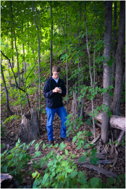
    Geocaching is a real-world, outdoor treasure hunting game using GPS-enabled devices. Participants navigate to a specific set of GPS coordinates and then attempt to find the geocache (container) hidden at that location. Geocaching is a great way to find beautiful trails and places you wouldn’t normally hear about. Below are the www.geoaching.com official cache numbers and GPS coordinates to find each cache.

    What do you need?
    The only necessities are a GPS device or a GPS-enabled mobile phone so that you can navigate to the cache. If you wish to log your finds online, you’ll also need a www.geoaching.com account.

    Rules
    1. If you take something from the geocache (or "cache"), leave something of equal or greater value.
    2. Write about your find in the cache logbook.
    3. Log your experience at www.geoaching.com. We’d also love if you’d take a photo while caching and post it to our Facebook page. Try to be sneaky so as to not give away the location.


    Official geocaching.com numbers
    and GPS coordinates 


    Big Ravine Trail  
    GC5ZP7J —N 46° 49.063, W 090° 49.422

    Brownstone Trail - 2 Caches
    GC5Y68Y—N 46° 48.513, W 090° 49.194
    GC5Y69R—N 46° 47.822, W 090° 49.852  

    Cornucopia Beach 
    GC5ZP86 —N 46° 51.517, W 091° 6.170

     Frog Bay Tribal National Park
    GC5ZP9Y —N 46° 54.598, W 090° 47.161

    Lincoln Community Forest - 2 Caches
    GC5ZP8W —N 46° 21.500, W 090° 58.993 
    GC5ZP98 —N 46° 21.413, W 091° 0.112

    North Pikes Creek Wetlands 
    GC5ZPA7 —N 46° 51.354,  W 090° 52.357

    Bayfield Regional Conservancy ~ P.O. Box 410 ~33 N. 1st Street, Bayfield, WI 54814 ~ 715.779.5263 ~ [email protected]
    Proudly powered by Weebly
    • Home
    • What We Do
      • Where We Work >
        • Strategic Conservation Plans
      • Preserve Your Land >
        • Private Land Preservation
        • Farmland Preservation
        • Land & Water Preservation
        • Start an Easement
      • Trails & Public Land Preservation >
        • Big Ravine and Nature Trail >
          • Big Ravine - Upper Section Management Plan
        • Brownstone Trail
        • Cornucopia Beach
        • Frog Bay Tribal National Park
        • Gil Larsen Nature Trail
        • Houghton Falls Nature Preserve
        • Jerry Jay Jolly Trails
        • Lincoln Community Forest >
          • Lincoln Community Forest management plan
          • Lincoln Community Forest MFL plan
        • Lost Creek Bog State Natural Area
        • Mt. Ashwabay
        • Nourse Sugarbush State Natural Area
        • White River Fisheries Area
        • North Pikes Creek Wetlands Community Forest >
          • North Pikes Creek Beaver Trapping Permit
          • NPC Presentation June 2025
          • North Pikes Creek Management Plan
      • Siskiwit River Estuary Preserve Project
      • Tyler Forks Community Forest Project
      • Geocaching
      • Northern WI Sasquatch Preserve
      • Other Initiatives & Partnerships
    • How You Can Help/Donate
      • Donate
      • Monthly Giving
      • Become a Legacy Society Member
      • Other Ways to Give
      • Volunteer With Us
      • Native Plants
    • About BRC
      • Accreditation Renewal
      • Contact Us
      • Join the Mailing List
      • Staff >
        • Join Our Team
      • Board >
        • BOARD/STAFF ONLY
      • BRC History
      • Annual Reports
      • Strategic Plan
      • Meet Our Partners
    • What's Happening
      • Native Plant Sale 2025
      • Event Calendar
      • BRC "In the News"
      • Newsletter Archive
    • Store
    ✕