Trail Information and Directions
Length: 5 miles
Trail Difficulty: Moderate and wet
Owned/managed by the BRC
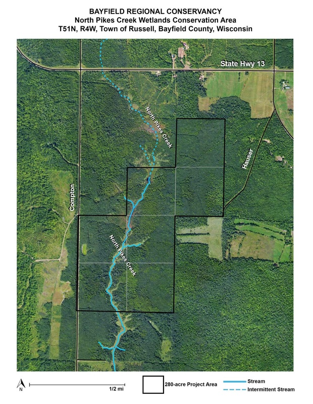
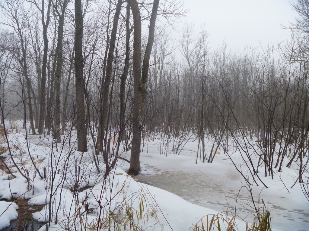
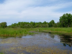
This community forest is 280 acres of headwater stream, forest, and wetland habitats in the North Pikes Creek watershed. The North Pikes Creek Wetlands Community Forest is open to the public for hiking, fishing, hunting, trapping, and cross country skiing among other non-motorized uses. Once a large cedar/lowland conifer swamp, we will be restoring this property both actively and passively over time to establish more conifers, instead of managing the property to encourage early successional plants.
Directions: Located in the Town of Russell near Hwy 13 and Compton Road. From Bayfield, travel north and west on Hwy 13 for 7.3 miles. Turn left onto Compton Rd. and drive approx. 1 mile. Property is marked with ownership signs and parking is available off road.
The Bayfield Regional Conservancy (BRC) acquired the North Pikes Creek Wetlands Community Forest - 280 acres of headwater stream, forest, and wetland habitats in the North Pikes Creek watershed - in September 2026. This could not have been done without the help of Futurewood Corporation and the Rathlef family (sellers) and WI DNR Knowles Nelson Stewardship Program and the USFS Community Forest Program (funders), or the Town of Russell community members who envisioned this project. The headwaters of North Pikes Creek (NPC) are located near the tip of the Bayfield Peninsula and are surrounded by ancient glacial mountains. As a home and a stopover to a diversity of species, the North Pikes Creek project also protects a Class 1 trout stream that provides a home to Brook trout.
The North Pikes Creek Wetlands Community Forest is open to the public for hiking, fishing, hunting, trapping (see below for beaver permit information), and cross country skiing among other non-motorized uses.
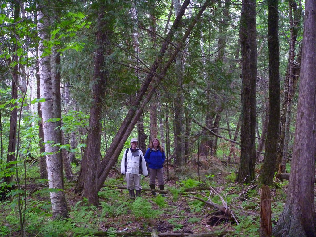
BRC has developed a management plan for the property that we use to help guide our work. We welcome help from both local and regional community members to implement future projects. Our main goal for the property is to restore lowland conifer species by increasing their presence on the property. This forest type provides many benefits including:
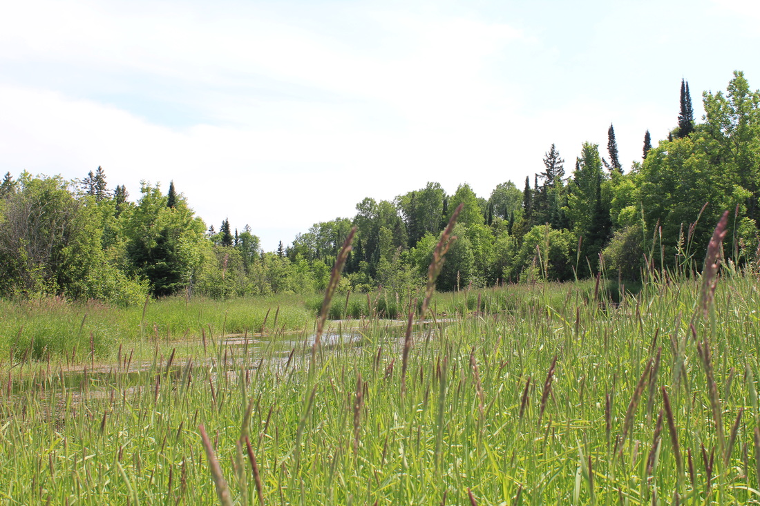
BRC will be allowing Beaver Trapping on the property BY PERMIT ONLY. Currently, the multiple North Pikes Creek beaver ponds are integral to the functioning of the wetlands, and helping to slow-the-flow of water across the landscape. . As such, retaining the site's beaver ponds for the conservation of the important bird/waterfowl habitats and overall watershed health is important. BRC will manage the beaver population to maintain optimum, sustainable numbers by a regulated permit system for beaver trapping. The establishment of this permit system will ensure the maintenance of a healthy beaver population while avoiding adverse depletion, or overpopulation. Trappers who are interested must visit the BRC office to receive permission. For more information, please see permission letter.
Length: 5 miles
Trail Difficulty: Moderate and wet
Owned/managed by the BRC
This community forest is 280 acres of headwater stream, forest, and wetland habitats in the North Pikes Creek watershed. The North Pikes Creek Wetlands Community Forest is open to the public for hiking, fishing, hunting, trapping, and cross country skiing among other non-motorized uses. Once a large cedar/lowland conifer swamp, we will be restoring this property both actively and passively over time to establish more conifers, instead of managing the property to encourage early successional plants.
Directions: Located in the Town of Russell near Hwy 13 and Compton Road. From Bayfield, travel north and west on Hwy 13 for 7.3 miles. Turn left onto Compton Rd. and drive approx. 1 mile. Property is marked with ownership signs and parking is available off road.
The Bayfield Regional Conservancy (BRC) acquired the North Pikes Creek Wetlands Community Forest - 280 acres of headwater stream, forest, and wetland habitats in the North Pikes Creek watershed - in September 2026. This could not have been done without the help of Futurewood Corporation and the Rathlef family (sellers) and WI DNR Knowles Nelson Stewardship Program and the USFS Community Forest Program (funders), or the Town of Russell community members who envisioned this project. The headwaters of North Pikes Creek (NPC) are located near the tip of the Bayfield Peninsula and are surrounded by ancient glacial mountains. As a home and a stopover to a diversity of species, the North Pikes Creek project also protects a Class 1 trout stream that provides a home to Brook trout.
The North Pikes Creek Wetlands Community Forest is open to the public for hiking, fishing, hunting, trapping (see below for beaver permit information), and cross country skiing among other non-motorized uses.
BRC has developed a management plan for the property that we use to help guide our work. We welcome help from both local and regional community members to implement future projects. Our main goal for the property is to restore lowland conifer species by increasing their presence on the property. This forest type provides many benefits including:
- slowing the flow of floodwaters and snowmelt that helps decrease sediment in the stream
- helping to store groundwater and provide cold water to the nearby stream; and
- habitat for many wildlife and plants
BRC will be allowing Beaver Trapping on the property BY PERMIT ONLY. Currently, the multiple North Pikes Creek beaver ponds are integral to the functioning of the wetlands, and helping to slow-the-flow of water across the landscape. . As such, retaining the site's beaver ponds for the conservation of the important bird/waterfowl habitats and overall watershed health is important. BRC will manage the beaver population to maintain optimum, sustainable numbers by a regulated permit system for beaver trapping. The establishment of this permit system will ensure the maintenance of a healthy beaver population while avoiding adverse depletion, or overpopulation. Trappers who are interested must visit the BRC office to receive permission. For more information, please see permission letter.