Houghton Falls Nature Preserve Hiking Information
Distance: 1.5 miles
Trail Difficulty: Easy
Hours: Roughly sunrise to sunset. An automatic gate has been installed, and tickets are issued to visitors who are in the Preserve after hours. During the winter, the Preserve closes at 4:30 pm.
Owned/managed by the Town of Bayview
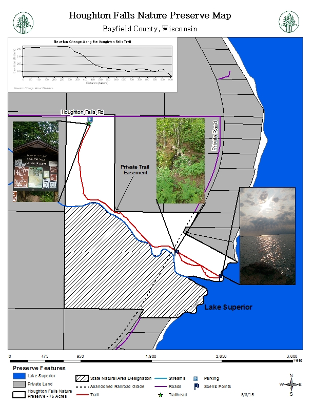
Map
A 76-acre nature preserve located in the Town of Bayview just outside of the City of Washburn, this property was protected through a collaborative effort of private landowners, Town of Bayview, conservation organizations (the BRC and Trust for Public Land), the Wisconsin Department of Natural Resource's Knowles Nelson Stewardship Fund, and NOAA's Coastal and Estuarine Land Conservation Program. The Bayfield Regional Conservancy holds a conservation easement on the property and has a responsibility in enforcing the protection of the natural habitats and works with the Town of Bayview and volunteers to do so.
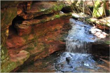
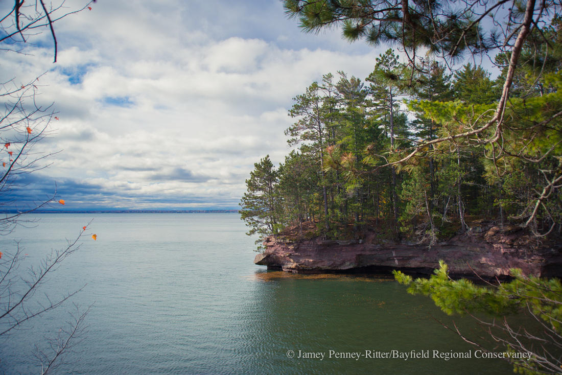
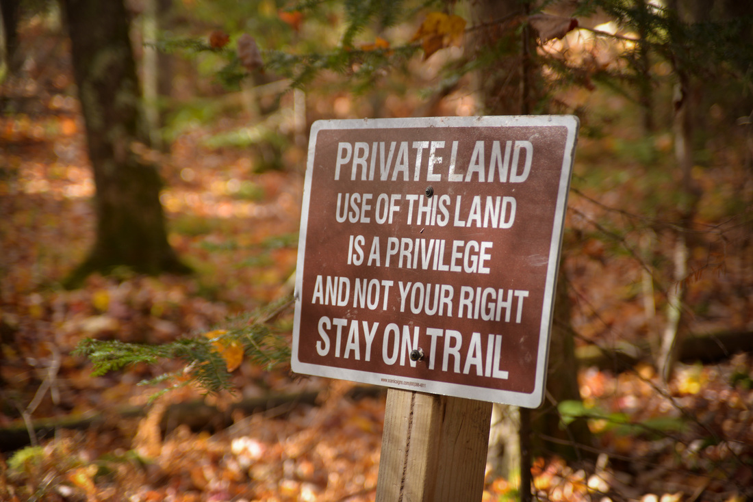
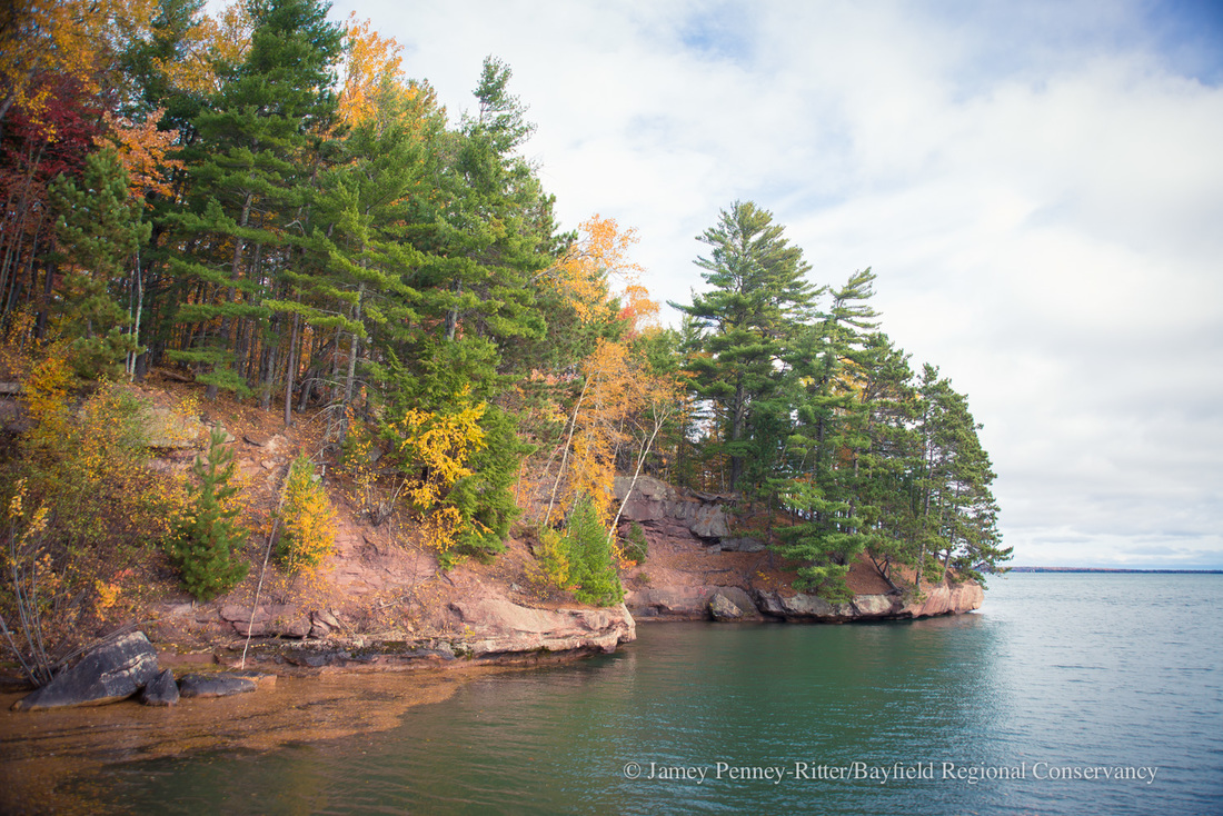
Houghton Falls Nature Preserve was protected for its significant natural, ecological, scenic, geological, recreational, and educational values. When visiting the property, you can enjoy the boreal forest of pines and hemlocks, sandstone cliffs, seasonal waterfalls, Lake Superior’s rocky shoreline, and a lagoon. The trail ends at views of the Chequamegon Bay and the Apostle Islands. Please respect private property along the trail and in Echo Dells; The narrow trail is well signed and wandering off it contributes to erosion, soil compaction, and spread of invasive species. After the Dells you will cross a bridge and follow a narrow path to Houghton Point. Return via the same route.
Directions: Drive 8.8 miles South of Bayfield or miles north of Washburn on Hwy 13. Turn onto Houghton Falls Road and go .5 miles to the Houghton Falls Nature Preserve parking lot (on the right). Parking on the road is prohibited. Please note seasonal changes in hours.
Please note: Bikes are not allowed in the Preserve. The Echo Dells area is private property and hikers should refrain from hiking down in the streambed.
Distance: 1.5 miles
Trail Difficulty: Easy
Hours: Roughly sunrise to sunset. An automatic gate has been installed, and tickets are issued to visitors who are in the Preserve after hours. During the winter, the Preserve closes at 4:30 pm.
Owned/managed by the Town of Bayview
Map
A 76-acre nature preserve located in the Town of Bayview just outside of the City of Washburn, this property was protected through a collaborative effort of private landowners, Town of Bayview, conservation organizations (the BRC and Trust for Public Land), the Wisconsin Department of Natural Resource's Knowles Nelson Stewardship Fund, and NOAA's Coastal and Estuarine Land Conservation Program. The Bayfield Regional Conservancy holds a conservation easement on the property and has a responsibility in enforcing the protection of the natural habitats and works with the Town of Bayview and volunteers to do so.
Houghton Falls Nature Preserve was protected for its significant natural, ecological, scenic, geological, recreational, and educational values. When visiting the property, you can enjoy the boreal forest of pines and hemlocks, sandstone cliffs, seasonal waterfalls, Lake Superior’s rocky shoreline, and a lagoon. The trail ends at views of the Chequamegon Bay and the Apostle Islands. Please respect private property along the trail and in Echo Dells; The narrow trail is well signed and wandering off it contributes to erosion, soil compaction, and spread of invasive species. After the Dells you will cross a bridge and follow a narrow path to Houghton Point. Return via the same route.
Directions: Drive 8.8 miles South of Bayfield or miles north of Washburn on Hwy 13. Turn onto Houghton Falls Road and go .5 miles to the Houghton Falls Nature Preserve parking lot (on the right). Parking on the road is prohibited. Please note seasonal changes in hours.
Please note: Bikes are not allowed in the Preserve. The Echo Dells area is private property and hikers should refrain from hiking down in the streambed.