Lincoln Community Forest
Trail Information and Directions
Length: 5 miles
Trail Difficulty: Easy to Moderate
Owned/managed by Bayfield Regional Conservancy
Map
Directions: From the community of Sanborn, take County E 3 miles south and west to Four Corners Store Road. Travel south and west on Four Corners Store Rd for 5 miles. At the Town Hall, travel west on Altamont Rd for .5 miles to Marengo River Rd. Travel .25 mile on Marengo River Rd to the trailhead. The entrance to the forest can be found at 28430 Marengo River Road.
Entrances to the forest can be found at 28430 Marengo River Road, 28350 Marengo River Road, and 27000 Gerber Road.
Geocaches
GC5ZP8W —N 46° 21.500, W 090° 58.993
GC5ZP98 —N 46° 21.413, W 091° 0.112
Background Information
The Lincoln Community Forest, the first US Forest Service funded Community Forest in Wisconsin, was created in 2026 in partnership with funding from the Wisconsin Knowles-Nelson Stewardship Program and the US Forest Service Community Forest Program. When approximately 400 acres came available through Plum Creek Timber Company, the BRC obtained funding through competitive WI DNR and USFS grant programs to purchase the property. In addition to its high quality forest habitat for a variety of wildlife, the Lincoln Community Forest protects approximately 2 miles of frontage along a highly erodible section of the Marengo River.
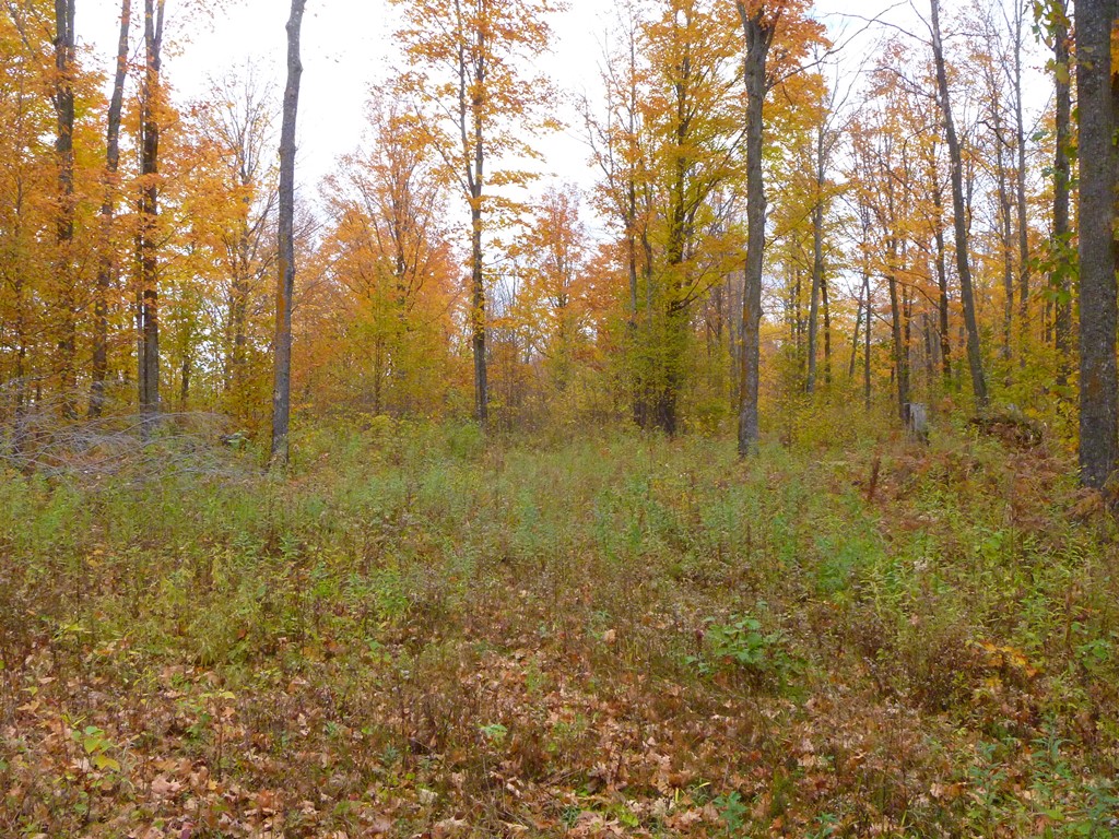
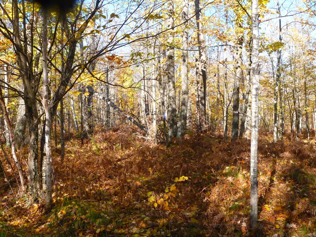
The Marengo River is a Priority Conservation Area for the BRC due to its biological diversity, presence of rare and endangered species, and its importance for the health of the Bad River and the Kakagon Slough. Additionally, the BRC holds a conservation easement on a 270-acre adjacent property in partnership with private landowners. The Lincoln Community Forest offers a variety of non-motorized recreation opportunities to the public including hiking, wildlife viewing, birding, snowshoeing, cross-country skiing, fishing, trapping, and hunting.
The Lincoln Community Forest is enrolled in Wisconsin's Managed Forest Law (MFL) Program. As such, it is a WORKING FOREST and the BRC will be scheduling harvest practices to meet MFL requirements. Please see the MFL plan for more details. In doing so, we will continue to protect fragile soils along the river and wetland areas too.
Additionally, the Lincoln Community Forest is a project of The Climate Change Response Framework, a collaborative, cross-boundary approach among scientists, managers, and landowners to incorporate climate change considerations into natural resource management. It provides an integrated set of tools, partnerships, and actions to support climate-informed conservation and forest management. For the Lincoln Community Forest, climate change was identified as a forest management issue early in the development of the forest management plan and was considered throughout the process. As such, several adaptation actions were identified to help the community forest adapt to changing conditions.
While the BRC currently owns and manages the property, we have help from the Friends of the Lincoln Community Forest, a local organization that formed to help manage the property. The Friends have led trail building activities, constructed a parking lot and trailhead, and an informational kiosk is in the works. Please see attached management plan for the property that we use to help guide our work.
Check learn more about the Friends of the Lincoln Community Forest on their website at www.friendslcf.com
Trail Information and Directions
Length: 5 miles
Trail Difficulty: Easy to Moderate
Owned/managed by Bayfield Regional Conservancy
Map
Directions: From the community of Sanborn, take County E 3 miles south and west to Four Corners Store Road. Travel south and west on Four Corners Store Rd for 5 miles. At the Town Hall, travel west on Altamont Rd for .5 miles to Marengo River Rd. Travel .25 mile on Marengo River Rd to the trailhead. The entrance to the forest can be found at 28430 Marengo River Road.
Entrances to the forest can be found at 28430 Marengo River Road, 28350 Marengo River Road, and 27000 Gerber Road.
Geocaches
GC5ZP8W —N 46° 21.500, W 090° 58.993
GC5ZP98 —N 46° 21.413, W 091° 0.112
Background Information
The Lincoln Community Forest, the first US Forest Service funded Community Forest in Wisconsin, was created in 2026 in partnership with funding from the Wisconsin Knowles-Nelson Stewardship Program and the US Forest Service Community Forest Program. When approximately 400 acres came available through Plum Creek Timber Company, the BRC obtained funding through competitive WI DNR and USFS grant programs to purchase the property. In addition to its high quality forest habitat for a variety of wildlife, the Lincoln Community Forest protects approximately 2 miles of frontage along a highly erodible section of the Marengo River.
The Marengo River is a Priority Conservation Area for the BRC due to its biological diversity, presence of rare and endangered species, and its importance for the health of the Bad River and the Kakagon Slough. Additionally, the BRC holds a conservation easement on a 270-acre adjacent property in partnership with private landowners. The Lincoln Community Forest offers a variety of non-motorized recreation opportunities to the public including hiking, wildlife viewing, birding, snowshoeing, cross-country skiing, fishing, trapping, and hunting.
The Lincoln Community Forest is enrolled in Wisconsin's Managed Forest Law (MFL) Program. As such, it is a WORKING FOREST and the BRC will be scheduling harvest practices to meet MFL requirements. Please see the MFL plan for more details. In doing so, we will continue to protect fragile soils along the river and wetland areas too.
Additionally, the Lincoln Community Forest is a project of The Climate Change Response Framework, a collaborative, cross-boundary approach among scientists, managers, and landowners to incorporate climate change considerations into natural resource management. It provides an integrated set of tools, partnerships, and actions to support climate-informed conservation and forest management. For the Lincoln Community Forest, climate change was identified as a forest management issue early in the development of the forest management plan and was considered throughout the process. As such, several adaptation actions were identified to help the community forest adapt to changing conditions.
While the BRC currently owns and manages the property, we have help from the Friends of the Lincoln Community Forest, a local organization that formed to help manage the property. The Friends have led trail building activities, constructed a parking lot and trailhead, and an informational kiosk is in the works. Please see attached management plan for the property that we use to help guide our work.
Check learn more about the Friends of the Lincoln Community Forest on their website at www.friendslcf.com
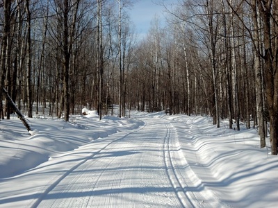
Enjoy the maintained hiking trails and cross-country ski trails on the property! Volunteers of The Friends of the Lincoln Community Forest are instrumental in keeping these up! Thank you!