Bayfield Regional Conservancy
  • Home
  • What We Do
    • Where We Work >
      • Strategic Conservation Plans
    • Preserve Your Land >
      • Private Land Preservation
      • Farmland Preservation
      • Land & Water Preservation
      • Start an Easement
    • Trails & Public Land Preservation >
      • Big Ravine and Nature Trail >
        • Big Ravine - Upper Section Management Plan
      • Brownstone Trail
      • Cornucopia Beach
      • Frog Bay Tribal National Park
      • Gil Larsen Nature Trail
      • Houghton Falls Nature Preserve
      • Jerry Jay Jolly Trails
      • Lincoln Community Forest >
        • Lincoln Community Forest management plan
        • Lincoln Community Forest MFL plan
      • Lost Creek Bog State Natural Area
      • Mt. Ashwabay
      • Nourse Sugarbush State Natural Area
      • White River Fisheries Area
      • North Pikes Creek Wetlands Community Forest >
        • North Pikes Creek Beaver Trapping Permit
        • NPC Presentation June 2025
        • North Pikes Creek Management Plan
    • Siskiwit River Estuary Preserve Project
    • Tyler Forks Community Forest Project
    • Geocaching
    • Northern WI Sasquatch Preserve
    • Other Initiatives & Partnerships
  • How You Can Help/Donate
    • Donate
    • Monthly Giving
    • Become a Legacy Society Member
    • Other Ways to Give
    • Volunteer With Us
    • Native Plants
  • About BRC
    • Accreditation Renewal
    • Contact Us
    • Join the Mailing List
    • Staff >
      • Join Our Team
    • Board >
      • BOARD/STAFF ONLY
    • BRC History
    • Annual Reports
    • Strategic Plan
    • Meet Our Partners
  • What's Happening
    • Native Plant Sale 2025
    • Event Calendar
    • BRC "In the News"
    • Newsletter Archive
  • Store

Where We Work

  • el
  • pt
  • "Look deep into nature, and then you will understand everything better."
    -Albert Einstein
    Donate
    The Bayfield Regional Conservancy preserves natural lands, waters, forests, farms, and places of scenic, historic and spiritual value in Ashland, Bayfield, Douglas and Sawyer Counties. These lands are the special places you love, places that provide habitat for our wildlife and plants.
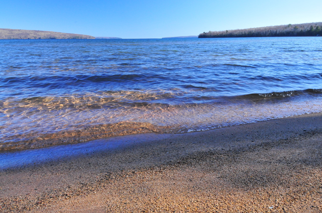
    Preserve Your Private Land
    Trails/Public Land
    Partner Programs
    Explore Our Public Project Sites
    Picture
    Picture
    Picture
    Picture
    Picture
    Picture
    Picture
    Picture
    Picture
    Picture
    Picture
    Lake Superior

    Holding 10% of the world's freshwater, Lake Superior is not only the largest freshwater lake in the world but it also holds 10% of the world's freshwater, and home to:
    • Apostle Islands National Lakeshore,
    • Chequamegon Bay,
    • Bad River Estuary- the lake's largest, most productive wetland
    Wisconsin’s Lake Superior Shoreline is incredibly scenic, rich in animal and plant species, and is the most pristine of the Great Lakes. Lake Superior is also threatened. Development for resorts and second homes, incompatible land use on the rivers that drain into Lake Superior and mining all threaten the quality of Lake’s Superior’s water, its fisheries, and its habitats.
    The Conservancy protects Lake Superior by:
    • Preserving Lake Superior shoreline habitats,
    • Protecting river shoreline where it is needed most,
    • Promoting forestry practices that are sustainable, reduce runoff, and help preserve water quality.

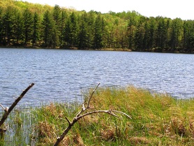
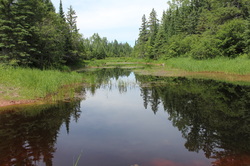
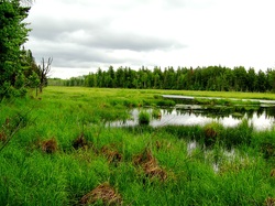
    Our Numerous Inland Lakes

    Our north woods region is rich in inland lakes, a legacy of our glacial history. Our lakes come in many forms and the most common in our region include:
    • seepage lakes - that are land locked and fed mostly by precipitation, resulting in highly fluctuating water levels,
    • spring lakes that have no inlet but do have an outlet and are fed by groundwater,
    • drainage lakes that have both an inlet and outlet and whose main water source is stream drainage and,
    • impoundments that are man-made lakes formed along a river using a dam or other type of control structure.
    Many of our lakes are rich in fish and other aquatic creatures but they are highly threatened by development. The pressure of recreational property development hits inland lakes the hardest, resulting in the loss of habitat along the lakeshore, affecting water quality and aquatic habitat for fish and other creatures.
     
    The Bayfield Regional Conservancy works to protect lake habitat and species in the following ways:
    • by working with private landowners to protect shoreline properties from further subdivision
    • protecting natural shoreline habitats such as wetlands and forests, to keep water quality high and improve aquatic habitats,
    • working to protect large blocks of forest habitat and natural habitat corridors resulting in improved water quality and diversity of animal and plant species,
    • promoting healthy land management practices that help preserve water quality.

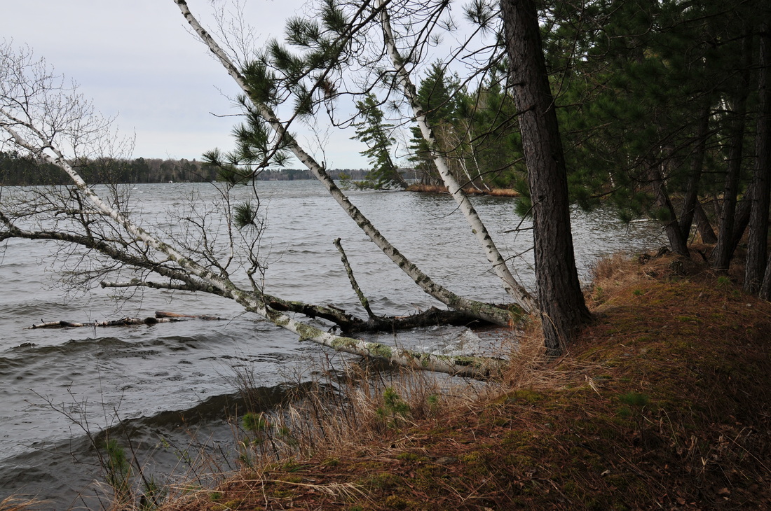
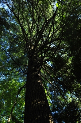
    Our Rich Northwoods Forests

    Our forests provide us with clean air and filter the water we drink.  They also help maintain the water quality of our rivers and streams by slowing the flow of water and reducing runoff. Our forests provide habitat for:
    • migratory songbirds like Blackburn warblers, American Redstart, Cerulean warblers and Vireos.
    • They are home to black bear, fisher, gray wolf, Canada lynx, bobcat, American martens, red tailed hawks, bald eagles, to name only a few.

    The Bayfield Regional Conservancy has protected over 2,000 acres of forestland in our service area.  We continue to preserve our precious forest habitats in the following ways:
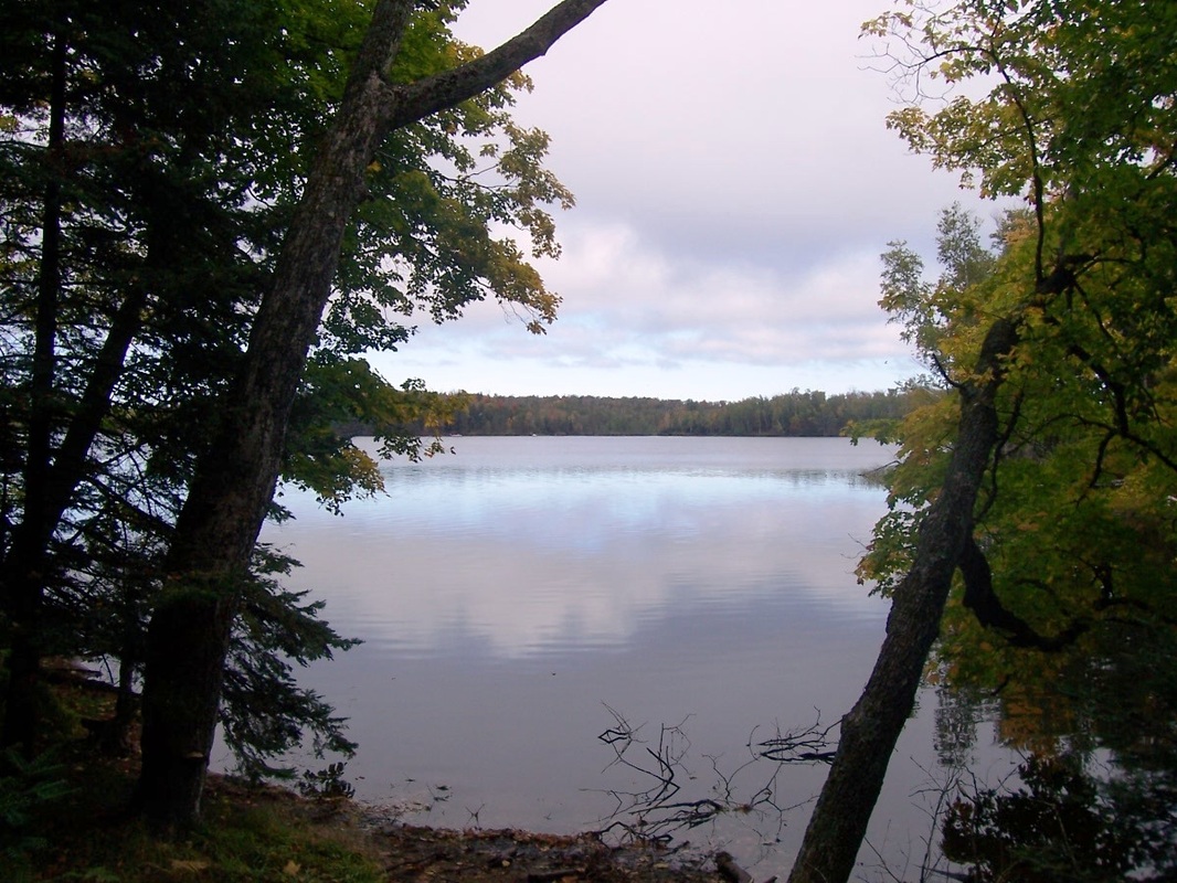
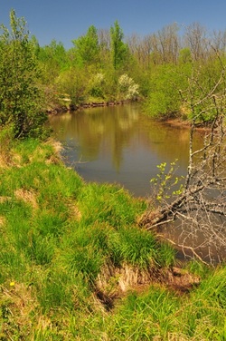
    • developing permanent land management agreements with private landowners to keep forestland from being further subdivided and developed,
    • buying important and unique forest habitats and setting them aside as nature preserves, town forests, and county forests,
    • promoting sustainable forest management through partnerships with the Living Forest Cooperative, workshops and publications.  Forestry is a way of life for our region and an important part of our local economy.

    Our Pristine Rivers

    Healthy rivers provide drinking water, flood protection, fish and wildlife habitat, recreation opportunities, and economic benefits to local communities. Our rivers include high quality trout streams, outstanding and exceptional resource waters, and they feed productive estuaries.

    Much of the Bayfield Regional Conservancy’s work includes river protection. The Conservancy’s service area comprises two major watersheds:
    • more than 75% of Wisconsin's Lake Superior Basin including the Bad River, Iron R., Fish Creek, White R., Marengo R., St. Louis R., Bois Brule R., Raspberry R., Cranberry R., Nemadji R.;
    • headwaters of the Mississippi River including the Upper Chippewa R., Totagatic R., Flambeau R., St. Croix R., Eau Claire R., Namekagon R., Tamarack R.

    What we do on the land affects the water of our rivers, especially along the shorelines.   Natural habitat on river shorelines keeps our rivers healthy by:

    • providing shade over the water and maintaining the cooler temperatures preferred by our cold water loving fish like trout,
    • falling into the water or dropping branches which create fish habitat,
    • dropping leaves which provide nutrients,
    • filtering water before it reaches the river, helping to maintain water quality,
    • slowing the rate at which water flows over land into the river, lessening the degree and frequency of erosion and flooding.

    The Conservancy works to protect our northern rivers by:

    • working with private landowners to protect river shoreline properties from further subdivision and development,
    • protecting natural shoreline habitats such as wetlands and forests, to keep water quality high and improve aquatic habitats,
    • working to protect large blocks of forest habitat and natural habitat corridors resulting in improved water quality and diversity of animal and plant species,
    • helping the Wisconsin DNR secure additional river front properties for Fisheries Habitat Areas and Wildlife Areas,
    • promoting healthy land management practices that help preserve water quality.

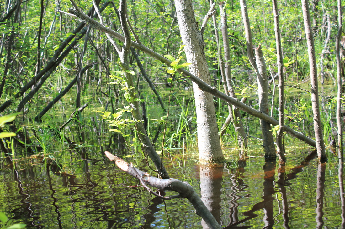
    Our Fertile Wetlands

    In addition to their scenic beauty and habitat values, our wetlands help prevent floods and purify our water. They recharge our groundwater and filter out pollutants, acting like the kidneys of our environment.  By acting like sponges and absorbing runoff, wetlands help prevent flooding because they hold the excess water, slowly releasing it to the groundwater, rivers, streams and lakes.  In the form of estuaries, they provide vital habitat for fish and other aquatic creatures.

    Our region is rich both in the types of wetland communities and the amount of acres of wetlands that occur here. Some of our wetland dependent creatures include mink, muskrat, herons, egrets, terns, rails, songbirds, sand hill cranes, ducks, and other small mammals and birds.

    Some of the Conservancy’s priority wetland sites include among others:
    • Lost Creek Bog and Bark Bay
    • Bibon Swamp
    • Brule Glacial Spillway
    • Blueberry Swamp
    • Sand River Slough
    • The Kakagon Sloughs and Bad River Estuary

    The Conservancy protects wetland habitats through:
    • developing permanent land management agreements with private landowners to keep wetlands intact,
    • buying important and wetland habitats and setting them aside as nature preserves in collaboration with local governments and the Wisconsin DNR,
    • promoting the protection of adequate upland buffer habitats adjacent to wetlands.
    _Bayfield Regional Conservancy ~ 33 N. 1st Street, Bayfield, WI 54814 ~ 715.779.5263 ~ [email protected]
    Proudly powered by Weebly
    • Home
    • What We Do
      • Where We Work >
        • Strategic Conservation Plans
      • Preserve Your Land >
        • Private Land Preservation
        • Farmland Preservation
        • Land & Water Preservation
        • Start an Easement
      • Trails & Public Land Preservation >
        • Big Ravine and Nature Trail >
          • Big Ravine - Upper Section Management Plan
        • Brownstone Trail
        • Cornucopia Beach
        • Frog Bay Tribal National Park
        • Gil Larsen Nature Trail
        • Houghton Falls Nature Preserve
        • Jerry Jay Jolly Trails
        • Lincoln Community Forest >
          • Lincoln Community Forest management plan
          • Lincoln Community Forest MFL plan
        • Lost Creek Bog State Natural Area
        • Mt. Ashwabay
        • Nourse Sugarbush State Natural Area
        • White River Fisheries Area
        • North Pikes Creek Wetlands Community Forest >
          • North Pikes Creek Beaver Trapping Permit
          • NPC Presentation June 2025
          • North Pikes Creek Management Plan
      • Siskiwit River Estuary Preserve Project
      • Tyler Forks Community Forest Project
      • Geocaching
      • Northern WI Sasquatch Preserve
      • Other Initiatives & Partnerships
    • How You Can Help/Donate
      • Donate
      • Monthly Giving
      • Become a Legacy Society Member
      • Other Ways to Give
      • Volunteer With Us
      • Native Plants
    • About BRC
      • Accreditation Renewal
      • Contact Us
      • Join the Mailing List
      • Staff >
        • Join Our Team
      • Board >
        • BOARD/STAFF ONLY
      • BRC History
      • Annual Reports
      • Strategic Plan
      • Meet Our Partners
    • What's Happening
      • Native Plant Sale 2025
      • Event Calendar
      • BRC "In the News"
      • Newsletter Archive
    • Store
    ✕